
US ZIP Code vs Postcodes: Differences, Business Applications and More

When we have to send mail, whether within the country or internationally, there is one element that we should always write to ensure accurate delivery. It is a postal code, also known as a ZIP code in the US, and postcodes or pin codes in other English-speaking countries. It helps the postal service provider identify the delivery region and effectively plan the delivery route. In this blog, we will learn what a US ZIP code is, what postcodes are, and the difference between the two. We'll also answer the question, Is a ZIP code the same as a postal code? and know-how businesses across industries leverage it.
Key Takeaways
- ZIP code refers to the term given to postal codes in the US. In other countries like the UK, Australia, and Canada, these codes are called postcodes.
- ZIP code was designed out of the need to make mail sorting and delivery an easy process. Postcodes go beyond that and also provide location-based intelligence information of the given address.
- ZIP codes and postal codes are different. Postal codes can be numeric, alphabetic, or a combination of both. But ZIP codes are only numbers.
- Businesses across the industry use ZIP codes and postcodes for accurate delivery, customer targeting, marketing, fraud prevention, and disaster planning.
- Verifying ZIP codes and postcodes is necessary to ensure correct delivery, minimize return mail, and avoid unnecessary expenses.
- PostGrid’s address verification solution comes with the ZIP code look-up API, which facilitates ZIP codes and postcode verification.
What is a US ZIP Code?
The term ZIP code is an acronym for Zone Improvement Plan code, which is a system of postal codes designed by the United States Postal Services (USPS). It was introduced in 1963, and since the beginning, there have been five-digit ZIP codes. This term was coined to correspond with the word “zipping along” to suggest that using these codes will help with efficient and quick delivery of mail to the postal address. When writing an address, it is written in the same line as the city and state.
| Example:
New York, NY, 10014 |
History
The inception of ZIP codes began with the postal districts and zone numbers. In May 1943, the United States Post Office Department enforced a postal zone for 178 regions. It was created to help non-experienced clerks who would work in place of the postal workers going to the army. This zonal system helped them sort mail without having to learn anything about the delivery area of each city postal carrier.
In the early 1960s, the national postal system realized the need for organized five-digit postal codes, and thus ZIP codes were introduced in 1963. It was non-mandatory at that time. Along with the ZIP code database, two-letter state abbreviations were also introduced.
The first three digits of the ZIP code were designed by Robert Moon. These digits are called sectional center facilities (SCF). It is a postal facility that serves as a distribution and processing center for post offices in various areas. The remaining two digits of the ZIP codes were proposed by Henry Bentley Hahn Sr., and they pinpoint a more precise location within the SCF. In 1967, ZIP codes were made mandatory for second and third-class mailers, and they were soon adopted for general use in the country. As of 2024, there are four different types of ZIP codes in the USA.
- Standard: These are the most commonly used ZIP codes, used for general geographic zones.
- Unique: These are the ZIP codes assigned to buildings receiving a large volume of mail regularly. Take, for instance, the Empire State Building with its ZIP code 10118.
- Military: These are used to route mail to military stations in the USA or for military personnel of the US stationed abroad.
- Post office box only: These are used for places that have PO boxes and do not have any street address.
What are ZIP+4 Codes?
Later in 1983, USPS realized that they needed to enhance their postal services, make delivery efficient, and enhance its accuracy. To determine the geographic segment within the ZIP codes, it designed ZIP+4 codes. They are added after a hyphen with the standard ZIP codes in the format 00000-0000. They identify city blocks, groups of apartments, and buildings receiving a high volume of mail daily. Each post office box has its ZIP+4 codes; however, since they are optional and there is no uniform rule for them, you must check the ZIP+4 code on a look-up tool.
You can use the ZIP code lookup API offered by USPS. However, it only provides limited information. If you want detailed information about the address, such as the apartment number, floor number, ZIP+4 code, city, state, and more, you should use the PostGrid ZIP code lookup API. Our solution will cross-check the ZIP code against the USPS postal records and provide you with verified, accurate, and complete address information.
Full ZIP Codes Breakdown
Each digit of a ZIP code serves a purpose by representing a geographical zone in the country. Let us understand this with an example of a ZIP code, 90005.
- First digit: This is an identifier assigned to individual states or a group within the United States. It starts from 0, indicating the Northwest region, to 9, representing the far West Coast. In this case, it indicates that the ZIP code lies in the Western US, specifically California, Nevada, and other states.
- Second and third digits: This represents a sub-region within the group of states. In this case, the 0 represents a radius within the western region, particularly South California areas such as Los Angeles.
- Fourth and fifth digits: This represents a specific location within the subregion. It can be a local post office or a neighborhood. Here, it refers to the downtown Los Angeles area. Hence, this ZIP code is of a street or a place in the downtown area of Los Angeles.
While a ZIP code is a type of postal code, there is a difference between the two, especially the format and application. To give you clarity, we have discussed zip code vs. postal code in the section below.
💡Also Read: how do ZIP codes work

What is a Postcode?
It is a sequence of letters, numbers, or a combination of both that are used to identify a post office or delivery area and help in mail sorting and distribution. Unlike ZIP codes, which are only used in the USA and the Philippines, postcode is an international term used by different countries across the world. Depending upon the country, it can include a combination of letters and numbers, spaces, punctuation, and any other mark ranging between three to 10 characters. They may represent a city, state, building, or street name. Each country has its way of adding the postcode when writing an address. Take, for instance, in Australia, the postcodes are written in a line after the state abbreviation and before the country name.
| Example:
3478 |
In Canada, however, the postcodes are written in the same line as the state and city.
| Example:
TORONTO ON A2D 3F4 |
History
While the history of postcodes dates back to 1857 in the United Kingdom, it wasn’t until 1959 that they were tried in Norwich. While unsuccessful, this trial gradually paved the way for the current postal code system. Eventually, countries across the world started using postcodes. Take, for instance, Australia started using postcodes in 1967, and Canada implemented it in 1971.
Postcodes Format Breakdown
As mentioned above, every country has its way of writing the postcode. Moreover, some countries use alphabets, others use numbers, and many use a combination of both. Depending upon the country, the characters hold different significance. To help you understand how postcodes vary by country, we will break down each character for postcodes of the United Kingdom, Australia, and Canada.
United Kingdom
The postcodes in the UK are alphanumeric, consisting of an outward code and an inward code. They are separated by a space.
| Example:
SW2A 2AA |
- Outward code: It indicates the district and the sub-district where the mail is supposed to be delivered. It is two to four characters long and always starts with a letter. It may or may not end with a number or a letter.
- Inward code: It indicates the delivery region within a certain postal district. It is three characters long and always begins with a number.
Australia
The postcodes in Australia are four-digit numbers. The initial digit denotes a state or a territory, and the second digit indicates an area within that territory or state. The third digit defines the delivery point into a sub-region, and the fourth digit indicates a specific locality, suburb, or post office in that sub-region.
| Example:
2000 |
Canada
A Canadian postcode is an alphanumeric string consisting of two parts: Forward Sortation Area (FSA) and Local Delivery Unit (LDU). The first three characters are FSA, which signifies a major geographic area such as a province or territory. The remaining three characters are called LDU, which indicates the area within the FSA.
| Example:
K1A 0B1 |
You can use PostGrid’s address verification solution to verify postcodes and other components. Whether your customers or clients reside in Australia, the UK, or Canada, we have access to official postal records. You can trust us to provide you with verified and accurate address information for over 245 countries and territories.
 Also Read: What is Postcode
US ZIP Codes vs Postcodes
| Aspect | US ZIP Codes | Postcodes |
| Length | They are five digits long and may extend to nine digits with the addition of ZIP+4 codes. The ZIP+4 code is written after a hyphen, and it is consistent throughout the USA. | They range from anywhere between four and seven characters. Take, for instance, postcodes that are four digits in Australia but six characters in Canada. Moreover, postcodes in some countries might include spaces or punctuation between the characters. |
| Format | Only numbers | May consist of numbers, letters, or both. |
| Purpose | ZIP code systems simplify mail sorting and speed up delivery. | Aside from efficient mail delivery, it is used for collecting demographic data, location-based identification, census information, and more. |
| Managed by | The US ZIP codes are managed by the United States Postal Service. | Postal services of the respective country. Take, for instance, Australia Post, which manages the postcodes in Australia, and Canada Post is responsible for the management of postcodes in Canada. |
| Geographic Coverage | United States and the Philippines | They are used in other countries throughout the world except the US and the Philippines. |
What is a Postal Code?
Postal code is an umbrella term for ZIP codes and postcodes. It can either entirely be a series of numbers or consist of numbers and letters. They help sort the mail and ensure that the letters and packages get routed correctly and efficiently to the destination.
Is the Postal Code the Same as the ZIP Code?
No, an important aspect of ZIP vs. postal code is that the ZIP codes are a subset of postal codes. Another thing to keep in mind is the format. ZIP codes can only have numbers. Postal codes, as mentioned above, can be numbers, letters, or a combination of both.
Another crucial postal code vs zip code is the application. While ZIP codes are only used for mail sorting and delivery, postal codes help businesses by providing location-based intelligence information such as consumer behavior, market trends, etc. Postcodes can be used by businesses to design marketing campaigns and make well-informed strategies for maximum impact.
How do Businesses Use ZIP Codes and Postcodes?
Now that you have understood what ZIP codes, postcodes, and postal vs. ZIP codes are, let us dive into how different departments of businesses can utilize these codes to their advantage.
Delivery and Logistics
Businesses use ZIP codes and postcodes to ensure that their packages reach the correct address without any delay. Logistics algorithms can be used to optimize the delivery process and route, which will reduce transit time and fuel costs. This ensures that the delivery agent can take the quickest route to reach the destination. Moreover, using ZIP codes, businesses can geographically group the regions so that deliveries can be clustered in certain areas. This reduces fuel consumption and minimizes delays.
Customer Targeting and Marketing
Since postcodes provide highly detailed information about the area, businesses can use them to analyze customer demographics and segment audiences based on their behavior and preferences. They can then devise highly targeted marketing campaigns for maximum impact. They can send direct mail postcards, letters, and other promotional material with discounts, advertisements, and localized offers to engage customers within the proximity. Take, for instance, a company selling luxury goods that can target postcodes where high-income households are prevalent. A budget-friendly retailer, on the other hand, can target areas with price-sensitive customers.
Sales Analysis of Geographic Region
Businesses can use these codes to identify high-performing areas. By analyzing which geographic region has the highest sales volume, businesses can focus their efforts on expansion or optimization. Take, for instance, upon realizing that a certain area generates high sales, businesses can ensure they always have sufficient inventory. Moreover, by mapping sales performance through ZIP codes and postcodes, businesses can strategically allocate their resources for maximum impact. For example, businesses realize a certain area is underperforming. They can increase their sales outreach in that area or focus on local advertising.
Real Estate and Property Insights
ZIP codes and postcodes can help real estate businesses keep tabs on the price trends within specific geographic regions. It will help them understand which areas are appreciating or depreciating in value. The insights can also help them keep track of how many properties are available, how quickly they are selling, and the demands for specific types of property. Take, for instance, there is a limited number of properties on sale in a certain region, but the buyer demand is high, so real estate companies and agencies can demand higher prices for them.
Additionally, by analyzing ZIP codes and postcodes, real estate agents can provide buyers with comprehensive information about the locality. They can use this data to attract buyers looking for certain amenities and lifestyles like schools, parks, public transportation, etc.
Enhanced Accuracy in Emergency and Disaster Planning
Mapping ZIP codes and postcodes can help emergency response teams quickly identify which area is affected by the disaster. This will facilitate efficient coordination and prompt resource allocation. This insight will help them know which area needs evacuation assistance or shelter. ZIP codes and postcodes can also help them assess the intensity of the damage in a certain area. They can use this information to determine how much medical aid distribution is required.
Why Should You Verify ZIP Codes and Postcodes?
Improve Deliverability
With a verified ZIP code and postcode, you can rest assured that your package will land at the correct destination. This can be crucial when you are sending highly targeted direct mail to your clients or customers. Take, for instance, you sell winter wear, and upon market analysis, you found out that the population of 13241 zone is a regular customer of jackets and coats. Before sending an offer or discount on winter wear, you should check the ZIP code and postcode. This will ensure your marketing strategy yields desirable results. You can use PostGrid’s ZIP code lookup API to check if the code exists and is deliverable.
Minimize Return Mail
Incorrect or invalid codes can lead to undelivered mail. In most cases, when the postal service providers are unable to deliver the mail, they return it to the sender. This not only leads to delays but also puts the business’ reputation at risk since the customers won’t get their packages on time. By verifying the codes, you can ensure that your mail is delivered to the correct address the first time.
Reduce Operational Cost
Did you know that certain postal service carriers charge an additional fee for correcting addresses? Yes, carriers like UPS charge anywhere between $0.03 and $0.50 per address correction. For businesses sending bulk mail to clients, this can compound to a significant cost. Aside from this, when you send mail without verifying the code, you have to bear the additional cost of reshipping and handling returns. The best way to avoid these unnecessary costs is to verify the ZIP codes and postcodes using PostGrid’s ZIP code lookup API before sending the mail.
ZIP Code Lookup Checklist
- Use this checklist to follow a systematic approach to ensure accurate usage of ZIP codes.
- Ensure ZIP codes are in the correct five-digit (or nine-digit for ZIP+4) format.
- Verify that the ZIP code you have used matches the area you intend to send the package to.
- Use reliable ZIP code tools to cross-check them against official databases.
- For ZIP+4 codes, make sure they pinpoint to specific locations, such as a building or an apartment area.
- For international addresses, verify your ZIP codes against multiple verification databases.
- Before you send something across, check for recent code changes in the area. It is especially true for developing areas.
- Make sure the ZIP code you're mailing to is supported by the delivery carrier you want to use.
💡Also Read: French Southern Territories Address Verification
Verify ZIP Codes and Postcodes With PostGrid
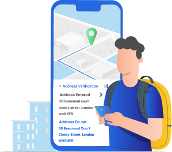
To ensure accurate delivery of your mail, you must verify the ZIP codes through an address verification solution like PostGrid. It has a ZIP code lookup API, which will provide verified, accurate, and granular information about a ZIP code. You will get details about the city, state, street address, building name, apartment number, floor number, ZIP+4 code, and other minute details.
If you are wondering why not use USPS for this, it is because it won’t allow bulk address validation. With PostGrid you can verify over 200k addresses in one go. Just upload your contact list, and we will parse, verify, and standardize the address as per the official postal records. Since we are USPS CASS certified, we will only return accurate and verified addresses.
We go beyond ZIP code lookup and address verification and offer an address autocomplete API. We also provide real-time and verified address autocomplete suggestions to speed up the filling process and eliminate the possibility of data entry errors. If you want to know how our solution works, request a demo now.
FAQs
What Is the Difference Between Zip Codes and Postal Codes?
ZIP codes are exclusively used in the United States for mail sorting and delivery. It generally consists of five digits, but could be extended to nine digits for ZIP+4 codes for precise locations. Postal codes, on the other hand, vary in formats, including numbers, letters, or both, depending on the country.
Why Are ZIP Codes Important for Businesses?
ZIP codes help businesses ensure accurate and efficient mail delivery, allowing them to target specific geographic areas for marketing, sales analysis, and customer segmentation. They also help optimize delivery routes, reduce operational costs, and prevent fraud by verifying addresses.
How Can Businesses Use ZIP Codes for Geographic Sales Analysis?
Businesses can analyze sales performance by ZIP code to identify high-performing or underperforming regions. By mapping sales data to ZIP codes, companies can better allocate resources, plan inventory, and target specific areas for expansion or focused marketing efforts.
How Does Address Verification Improve Delivery Accuracy?
Using address verification tools ensures that ZIP codes, postal codes, and addresses are correct, reducing the risk of undelivered or delayed mail. Verifying addresses minimizes errors, prevents return mail, and reduces operational costs, which is crucial for businesses sending bulk mail or marketing materials.
What Are the Challenges Faced by Postal Services Globally in Managing ZIP Codes and Postcodes?
Postal services worldwide face challenges like updating postal codes due to urbanization, population shifts, and geographic changes. Address data quality issues, especially in international mail systems, can lead to delivery errors, making accurate address verification increasingly important.
How Do ZIP Codes Help in Emergency Planning and Disaster Relief?
ZIP codes play a crucial role in disaster response and emergency planning. By mapping affected areas to specific ZIP codes, emergency responders can quickly identify regions in need of assistance, allocate resources effectively, and ensure aid reaches the right locations during emergencies.