
What Is Reverse Geocoding, And How Can You Utilize It?
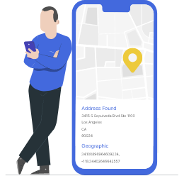
The reverse geocoding service is the process of converting latitude and longitude coordinates into readable street addresses and postal codes. Many vendors provide this service in the form of an API or software. Reverse geocoding does the exact opposite of geocoding, which is finding geographic coordinates using specific locations.
Here’s how it works:
- Provide a valid set of geographical coordinates: 40.729675, -73.996925
- Receive a standardized address: 70 Washington Square South, New York, NY 10012, USA
TL;DR
- Reverse geocoding converts latitude and longitude into human-readable addresses, useful for various business applications.
- It enhances customer databases, aids in direct mail marketing, and allows for accurate delivery updates.
- Accuracy levels vary, with rooftop geocoding being the most precise, while ZIP+4 offers the least reliability.
- Address verification tools are essential to ensure the reliability of addresses obtained through reverse geocoding.
- It is offered as a companion feature within comprehensive Address Verification APIs to help convert raw data into neat, deliverable addresses.
Key Takeaways
- Reverse geocoding takes raw coordinates corresponding to a physical location and converts them into precise, building-level addresses. These geocoding results enable you to use location-based services or find specific places within a city, state or province.
- Like geocoding results, these results are categorized into four: rooftop, parcel centroid, ZIP+4, and interpolated.
- Reverse geocoding allows you to enhance customer databases, send mail, get delivery updates, process payments, etc.
- The Google Maps platform may help you use online reverse geocoding. However, it does not guarantee accuracy and is not CASS-certified.

Reverse Geocoding has become one of the most frequently sought-after capabilities for businesses across industries. This is true for businesses belonging to numerous industries. However, the technology is relatively new, especially for business applications. Hence, there exists a lot of confusion surrounding reverse geocoding.
As you read on, you can find answers to your questions like “What is reverse geocoding?” and “How can it be used to improve deliverability?” “What is the level of precision of reverse geocoding?”. Furthermore, the article also explains geocoding in detail, geocoding API, and how you can use the capability to turn millions of data points into specific addresses with a single command.
What are Geocodes?
A geocode is a set of latitudinal and longitudinal coordinates. You can use the lat-long coordinates to indicate a physical location anywhere on Earth. The ability to show the physical location of an address helps decrease the risk of fraud and identity theft and increase operational efficiency.
Geocodes are similar to addresses in the sense that they are both used to represent a physical location. Some might even argue that geocodes are superior to addresses because they provide us with an exact location.
However, geocodes are numbers that can get quite confusing. Furthermore, relying solely on geocodes for standard operations such as mail deliveries can be difficult.
What is Forward Geocoding?
Geocoding is the process of converting the address of a location, for instance, 401 Biscayne Blvd, Miami, FL 33132, into its geocodes, such as 25.790742,-80.188586. Businesses, as well as individuals, use geocoding to determine the physical location of addresses. However, companies mostly use geocoding capabilities to improve their logistics, delivery success rates, and for marketing efforts.
Furthermore, geocoding also helps businesses to streamline their business processes. For example, companies can use a geocoding API for accurate plotting of delivery coordinates. They can then use it to optimize their delivery routing. It also allows for advanced mapping that enables you to get a better understanding of your audience.
The data thus obtained through geocoding can further be utilized for advanced targeting for your marketing campaigns. Furthermore, even governmental agencies depend on geocoding for their operations. Therefore, geocoding has already become a crucial technology in today's world.
What is the Reverse Geocoding API?
Reverse geocoding is both similar and different from regular geocoding. In geocoding, we use the address components as input to get the output, which is the geocodes of that location. Whereas in reverse geocoding, the input is the geocode of a place, and the result you get is the address.
Reverse geocoding is when coordinates are converted into a standardized address. It is the opposite of forward geocoding. Such a capability can come in handy for business applications. This is especially true if they don't have the address data but can access the geocodes.
In short, reverse geocoding enables you to get the actual addresses you don't even know. Although they have questionable accuracy, such a capability is a dream come true for direct mail marketers. In addition, you can use the data related to reverse geocoding for various day-to-day business operations.
Some of the major applications of reverse geocoding can be seen in the following operations.
- Direct mail marketing
- Customer database enhancement
- Device tracking
- Delivery updates
- Emergency services
- Fraud prevention
- Suspect and asset tracking
- Geofencing alerts
 Also Read: What are State County FIPS Codes?
Reverse Geocoding Coordinate Accuracies
Reverse geocode accuracy refers to the degree to which a set of geographic coordinates (latitude and longitude) matches the actual, physical location of a place on Earth. Depending on the density of local mapping data, structural configurations, and satellite readings, the accuracy of a returned address can vary significantly. To maintain control over data quality, here are the four distinct accuracy levels:
Rooftop Geocoding
Rooftop geocoding represents the absolute gold standard of spatial accuracy. At this tier, the latitude and longitude coordinates align precisely with the actual physical footprint or roofline of a specific building. For direct mail, high-value couriers, and localized emergency services, rooftop precision eliminates guesswork by confirming the exact structure associated with the location coordinates.
Parcel Centroid Geocoding
This segment of geocoding identifies the mathematical center point of a recognized property plot or land parcel. It could be a commercial office building or even a complex. While highly reliable for suburban areas or sprawling commercial centers, it may feature minor offsets in high-density urban environments where multiple vertical units or structures sit on a single plot of land.
Interpolated Geocoding
Interpolated geocoding uses mathematical algorithms to estimate an address location. When an exact coordinate pair isn't mapped, the system references two known bounding geocodes along a street segment (such as the beginning and end of a block) and calculates a relative midpoint. While useful for navigating new developments, interpolated data comes with an inherent margin of error and should be validated if used for transactional delivery workflows.
ZIP+4 Level Geocoding
Representing the broadest accuracy tier, administrative geocoding resolves coordinates strictly to a macro-regional zone, such as a ZIP+4 sector, postal code area, town, or city boundary. Because it identifies a collective zone rather than an individual structure, it cannot be used to pinpoint unique street addresses. Instead, it is ideal for macro-level market analytics, regional currency localization, and high-level demography.
Reliability of Reverse Geocoding
When we talk about reverse geocoding, it is vital that we also talk about its accuracy. However, as it is a new and budding technology yet to achieve its final form, reverse geocoding is yet to reach its prime. Therefore, the reliability of addresses obtained via reverse geocoding is questionable, at least, for now.
Now, as the accuracy of reverse geocode addresses is questionable, you need to verify such addresses. If you decide to go ahead with your direct mail campaign without verifying the accuracy of these addresses, you may end up wasting resources.
Thankfully, the verification part is easy as long as you can access an address verification API like PostGrid. In addition to this, PostGrid also comes equipped with a reverse geocoding feature. So, as long as you have a well-rounded tool like PostGrid, you can make the most out of reverse geocoding.
Why is the Reverse Geocoding API Service Important?
As we have mentioned before, companies or businesses employ reverse geocoding for several applications. But, one central aspect that has pushed for reverse geocoding in businesses is the geocodes themselves.
Sounds confusing?
Well, consider this, the geocode is a universal system that is used all around the world. Furthermore, sorting information using geocodes is much easier. This is especially true if yours is a business that deals with addresses from different countries that use their unique postal systems.
Therefore, any system that uses geocode as its base, such as geocoding and reverse geocoding, can be held to a universal standard. It also means that the reverse geocoding system can stand the test of time because it uses a sustainable model.
Reverse Geocoder Applications
One of the attractive aspects of reverse geocoding is that it identifies locations based on its geocodes. Why is this important? Because reverse geocoding enables you to access addresses that you didn't have before using nothing but the location's geocode.
Reverse geocoding can provide you with a reverse geocode address. The addresses are based on the nearest landmark, which can be pretty handy for businesses. Some of the major applications of reverse geocoding for businesses are listed below.
Direct Mail Marketing
Perhaps the best applicational use of reverse geocoding is in direct mail marketing. You can use geocodes to determine the address of new prospects and pitch them with well-drafted direct mail. This creates a seamless bridge for omnichannel campaigns for marketers who wish to convert anonymous mobile traffic by sending them targeted, direct mail pieces straight to the consumer's front door.
Customer Database Enhancement
One of the biggest challenges faced by businesses today is their inability to maintain a quality customer database. Reverse geocoding can enhance your customer database. It even enables you to fill up the addresses that are missing from your database. Clean, comprehensive location profiles ensure clearer customer segmentation and help weed out decaying data points.
Logistics An Delivery Updates
A major application of reverse geocoding is to send accurate delivery updates. Reverse geocoding instantly translates live vehicle GPS coordinates into clear, recognizable neighborhood or street updates, building customer trust through transparent delivery milestones. It can significantly reduce the tension of the customers who are searching for a missing or late purchase. You can provide them with real-time location updates. The service is invaluable for logistics, transport, and last-mile delivery providers.
Emergency Response
Reverse geocoding has the potential to revolutionize emergency services as we know it. For example, in an emergency, you can use reverse geocoding to accurately pinpoint the caller's location. It will, in turn, lead to faster deployment of the emergency response and potentially save lives. This technology can help with disaster management, aid routing efficiency, and improve emergency response for distressed callers.
Device Tracking For Marketing
Today, most devices, such as smartphones, capture the real-time location of the user using GPS coordinates. The marketers can then tap into the location data and reveal important details of the prospects. You can then utilize it in your marketing efforts for better results.
Fraud Prevention and Payment Validation
Financial institutions and merchant processors cross-reference a user's transaction coordinates against the registered billing address tied to their payment card. Suddenly, extreme geometric distance discrepancies between the transaction point and the billing address alert security systems, which can be captured and used to prevent potential fraud cases. This helps protect both businesses and consumers instantly.
Payment Processing
Consider an online purchase made by an international customer of yours. If you are a retailer with access to a reverse geocoding API like PostGrid, you can access the customer's location. Once you get the user's location, you can automatically set up your website to convert the product prices to the customer's local currency.
The reverse geocoding applications stated above are just a few of the major ones that are currently employed. However, reverse geocoding is still in its infancy, and it has a long way to go. In other words, the application potential of reverse geocoding is only limited by your innovative thinking or the lack of it.
Automated Ecommerce Localization
Enhancing the digital checkout experience is vital for lowering cart abandonment rates. By using a device's approximate background coordinates, reverse geocoding platforms allow e-commerce storefronts to automatically calculate local taxes, display the correct regional currency, and estimate accurate shipping windows before the user even types out their shipping details.
Law Enforcement and Legal Proceedings
Another massive use case for reverse geocoding is the ability to help with criminal proceedings and law enforcement. The GPS data from smartphones, vehicle GPS, or wearable devices collected during investigations can be translated to draw conclusions and figure out the historical locations of suspects as well as victims. Another way to utilize the tech is to extract metadata from photos, videos, or social media posts to determine exact locations.
Also Read: Loan Companies Promotion IdeasBatch Reverse Geocoding
The most easily accessible geocoding tool you can use is none other than Google. Yes, Google can provide you with the geocode of a location. It comes with a rooftop-level accuracy, and it is free! Now, Google also supports reverse geocoding capabilities.
You must now be asking yourself right “Why not just use Google reverse geocoding?”
The answer to this question can be put into just one word – reliability. Although Google offers a rooftop level of accuracy for its geocoding, there is no guarantee that it is right.
Just think about all the situations where Google Maps took you to the wrong address, and you will understand what we are talking about. In addition to poor reliability, the reverse geocoding process using Google is slightly more complex.
And last but not least, Google does not have a USPS-certified address verification capability like in PostGrid. As a result, businesses prefer to use an address verification API equipped with reverse geocoding capability. This way, you have a more reliable way to get access to addresses via reverse geocoding.
PostGrid vs Google Batch Reverse Geocoding
| Feature | Google Maps API | PostGrid API |
| Data Caching & Storage | Restricted access and not available for long-term storage or CRM caching. | Permitted to enrich databases, cleanse CRM systems, and store records. |
| Postal Standardization | Provides geographic data but does not check or format addresses according to official postal standards. | Native CASS-certified validates outputs into deliverable addresses with ZIP+4 codes. |
| Bulk File Uploads | Easy to set up for single requests, but cannot accept a bulk file. You must send your coordinates one by one, which requires extra coding to handle large lists. | Built for large workloads. You simply upload a single bulk file (like a CSV spreadsheet) with all your coordinates, and the system processes the list automatically. |
| Pricing Predictability | Pay-as-you-go based on strict usage totals. Clients are charged as per specific API requests and tied to volume and customized by geographic location. This can make monthly bills unpredictable. | Simple, volume-based tier pricing. You get predictable, flat rates designed specifically for large data sets. |
💡Also Read: New Caledonia Address Verification
Why Do You Need Address Verification Tools For Reverse Geocode Processes?
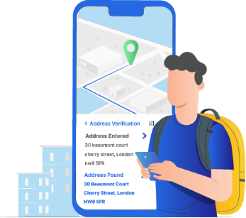
Address verification is a necessary part of reverse geocoding. This is because the address data obtained via reverse geocoding is not always reliable. For example, even using rooftop-level accurate geocodes, you can't ensure that an address is valid and deliverable according to the USPS.
CASS Certification
CASS certification implies that the software can access the USPS's official address database. Address verification or address validation confirms whether an address is deliverable. All you need to do is make sure that you employ a CASS-certified address verification API like PostGrid.
No Dedicated Reverse Geocoding Applications
There are no reliable dedicated reverse geocoding applications as of now. The best way to access the feature is to use an address verification software like PostGrid. This is because PostGrid comes equipped with reverse geocoding capability.
Quality Database And Additional Features
The address check can enhance the quality of your database. In other words, the addresses obtained via reverse geocoding are accurate and deliverable. PostGrid even provides you with additional features like Address Autocomplete. Such features can further enhance the user experience.
How PostGrid's Geocoding API Works
PostGrid integrates geocoding directly into its verification workflows. You can get geographic coordinates by passing the geocode=true parameter alongside a standard address verification request.
Request (JSON)
To query an address and extract its coordinates, send your data formatted as a JSON object inside your API request body:
| {
“line1”: “145 Mulberry St”, “city”: “New York”, “provinceOrState”: “NY”, “country”: “US” } |
Response (JSON)
When processed, the API returns the standardized address coupled with a geocodeResult object showing your coordinate metrics:
| {
“status”: “success”, “message”: “Address verification processed.”, “data”: { “line1”: “145 MULBERRY ST”, “city”: “NEW YORK”, “provinceOrState”: “NY”, “postalOrZip”: “10013”, “country”: “us”, “status”: “verified”, “geocodeResult”: { “location”: { “lat”: 40.719874, “lng”: -73.998462 }, “accuracy”: 1.00, “accuracyType”: “rooftop” } } } |
Conclusion
By converting geographic data points into standardized, deliverable locations, your enterprise can significantly refine its database integrity, elevate marketing ROI, and streamline last-mile delivery logistics.
Sign up to integrate reliable, CASS-certified reverse geocoding into your software suite!
FAQs
What Is the Main Difference Between Geocoding and Reverse Geocoding?
Geocoding (or forward geocoding) takes a textual, human-readable address (123 Main Street) and converts it into latitude and longitude coordinates for map plotting. Reverse geocoding does the exact opposite: it takes numeric latitude and longitude coordinates and translates them back into a structured street address.
Is Reverse Geocoding Always 100% Accurate?
Accuracy depends on the data tier returned by the engine. While rooftop accuracy matches coordinates precisely to a physical building, lower tiers like interpolated or ZIP+4 provide mathematical estimates or broader regional zones. Utilizing a CASS-certified tool ensures that the resulting text address is verified against official postal databases to improve accuracy.
What Formats are Batch Reverse Geocoding Results Returned In?
Enterprise geocoding APIs typically accept bulk uploads via formats like CSV or Excel sheets, and return structured programmatic codes via JSON, GeoJSON, or Python, making them highly compatible with standard databases and developer frameworks.